An Openmoko bike ride —
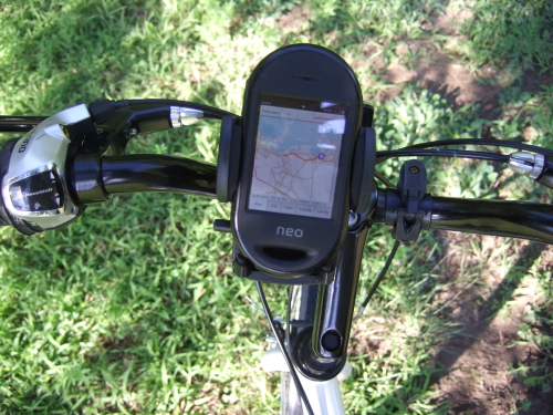
I’ve been having fun with new purchases recently: a new bike, and a Neo Freerunner phone from Openmoko. The phone is also my first GPS, and it’s doing a fine job as one:
Software for the Openmoko has come a long way since the previous model, with a pretty large community of developers building up. (I’ve tried to do my part by writing a patch to fix the touchscreen when the screen’s rotated into landscape mode.) I’m particularly pleased with tangoGPS, which uses data from OpenStreetMap and has some great features: you can zoom out to enclose an area and ask it to download all of the map tiles inside that area for offline viewing, up to a specified zoom level (so, I now have map images for most of Massachusetts sitting on my SD card). You can also publish your current location and get a moving map of friends. It’s written by a single developer, and I’d suggest making a donation to the project if you’re using it — think about how much such an app might cost if it were running on the iPhone instead of the Freerunner!
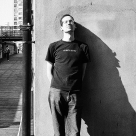
The bike mount in the photo above is an Arkon CM927, which I don’t recommend very highly; I’ve had the phone come off it (without major damage, which is good) twice now while riding over rough road. It should probably be strapped in separately, but that makes the whole thing less convenient. Let me know if you know of any better cell phone mounts.
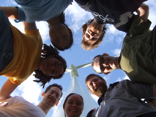
Okay, on to the bike ride, which happened yesterday. It was a beautiful day, and we rode from Quincy Center to the beaches at Hull and back, with a few extra-fit people riding from Somerville to Quincy at the start. Here’s a photo of the group:
We’ve taken the ferry back into Boston harbor twice now (once from Salem and this time from Quincy) and the trip and harbor look fantastic around sunset.
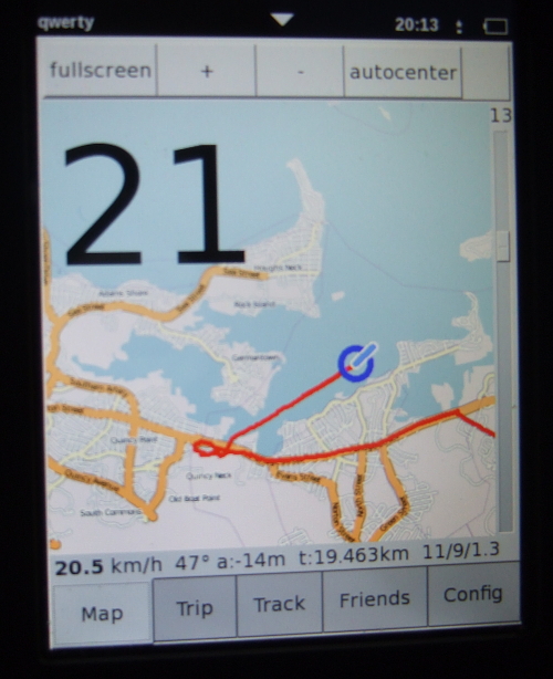
Finally, here’s a photo from tangogps:
well… i have a better bike mount for my neo1973.
i made it myself out of a piece of thermoplast.
I cut it out with a fretsaw and bent it over a candle until it fit my neo perfectly.
Now it is impossible for the neo to fall out of it – even if i would turn my bike upside down, since it will only slide out of the mount when i disconnect the gps antenna and usb charging cable.
here are some pictures and a drawing as svg:
http://rabenfrost.net/openmoko/bikemount/
cheers
josch
If you want/can spend some money, have a look at http://www.touratech.com (it’s for motorbikes but they sell bike mounts also) or http://www.ram-mount.com/
They have good mounts for all kind of GPS/PDA/Phones
Also, please make sure you record your tracks and upload them to http://openstreetmap.org 🙂
It looks great! What release for OpenMoko are you using? I recently received my OpenMoko and am going through the steps to bring it to life and install an image.
Have a look at this bikemount (with pictures)
http://andre.web-yard.de/blog/2008/08/03/neo-freerunner-rocks-hard-rides-free/
Heh, I think I may have seen you guys…
(I live in Quincy)
> It looks great! What release for OpenMoko are you using?
I’m using the FSO milestone 2 release at the moment.
Is it possible to read sunlit display during ride or is displa contrast too low for that?
> Is it possible to read sunlit display during ride or is displa contrast too low for that?
The contrast’s too low in sunlight. It works well in shade, and it’s just about visible in sunlight if you pull over and peer at it, but it’s not readable while moving in sunlight.
If that’s an issue, hooking up voice prompts through something like navit might help.
Unfortunately, I can’t get the GPS device in my FreeRunner to work at all (it never gets a fix). Have you had any trouble with that?
> Unfortunately, I can’t get the GPS device in my FreeRunner to work at all (it never gets a fix). Have you had any trouble with that?
No, I think I’ve been lucky. There are two things it could be:
* some people have reported bad soldering on the internal GPS antenna, which would stop you getting a fix. My phone seems fine.
* if you have an SD card plugged in, you should upgrade to a kernel that contains Andy Green’s SD clock workaround.